

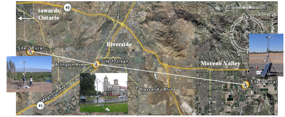
To understand the transition of the relatively simple rural to the complex urban boundary layer we organized and conducted a unique field study in the Riverside and Moreno Valley area. In this study, three sites were simultaneously instrumented with sonic anemometers, soil heat flux plates, infrared radiometers, krypton hygrometer, soil temperature probes, water content reflectometer, air temperature sensors, dusttraks and net radiometer. The mean nocturnal flow in the area is generally from the east. The first site, the urban site, was located in downtown Riverside in the back yard of the St. Catherine’s of Alexandria Catholic Church. The downwind rural site was located west of Riverside in the Hidden Valley Nature Preserve. The third upwind rural site was located east of Moreno Valley near the Fire Station 58. Figure below shows the locations of the sites.
| Research Opportunities |
|
Related Links |
Urban - Rural Field Campaign
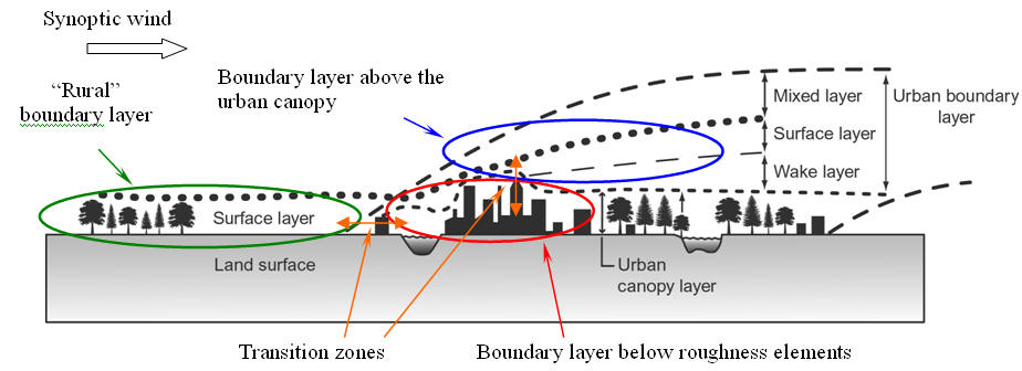
The structure of the atmospheric boundary layer is well understood over homogeneous rural areas and the resulting theories are widely used . On the other hand, the urban boundary layer requires special treatment because many of its features are governed by horizontal inhomogeneities associated with the inflow of rural air into the urban area with different surface characteristics. Methods are needed for estimating the flow field, turbulence and fluxes in the urban area knowing the incoming rural flow characteristics. This is especially important for nocturnal periods when the atmosphere is stable and leads to the trapping of pollutants near ground level. Figure below illustrates the urban/rural interface. In the presented schematic the mean synoptic forcing is from left to right. The rural boundary layer is modified by the urban area and several sub layers with distinct structure and dynamics are formed.